
Just to the south-southwest of Mindanao Island, lies a vast sea that is generally unexplored. A lot of geoscientists around the archipelago are interested in investigating this mysterious marine treasure. To be part of this project, which is driven by the purpose of discovering the untapped/potential mineral resources in the region, is truly a privilege. This was truly an exceptional experience, especially for a young geologist like me.
The 22-day journey comes about during the onset of the Christmas season. The team from the Mines and Geosciences Bureau – Central Office is comprised of the following: Technical staff- Dr. Rogel Santos (Team Leader), Arvien Terence D. Cudilla (me), Chelsi Grace Mendoza, Faye Anne De Leon; non-technical staff- Sheen Sanz, Mario Jandumon, Robert Maestro, Allan Magtoto, Sr., Ramon Rivera, Federico Balanon and Lamberto Melad. These personnel undertake the survey to accomplish the objective of this cruise to explore for minerals in on the seabed of Celebes. While others were busy preparing for the most anticipated holiday of the year, we were sailing on the territorial waters of our archipelago. From Manila to Zamboanga, all of us were doing our tasks preparing the tools and equipment that will be utilized during the exploration. Our non-technical personnel was busy re-painting the samplers and corers and we the geologists and other technical staff were discussing the sampling points that will be targeted during the geological and geophysical survey. Our team also did meetings to ensure that every staff/members were on the track with everyone’s duties and tasks and no one will be stagnant. Our cruise covered the nearshore/offshore areas of the provinces of the Zamboanga Sibugay, Zamboanga del Sur, Lanao del Norte, Lanao Del Sur, North Cotabato, Maguindanao, and Sultan Kudarat.
We employed several survey methods and techniques to achieve the objective of the project, which is to establish baseline data about the physical configuration of the seabed topography and geology of the area.
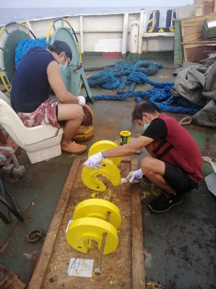
Figure 1. Re-painting of jar weights to be used for the piston corer
Bathymetric measurement is the method we did to get information about the submarine features of the area whether it is a flat area or it contains submarine features such as knobs, seamounts, submarine canyons, etc. This employs the concept of echo sounding whereby the time traveled by the transmitted wave to the seafloor and back to the vessel is measured to determine the distance it traveled. This data is converted by the device into a water depth reading. From the readings, we observed that the nearshore area of Eastern Zamboanga is generally flat, with some small knobs scattered while nearshore to offshore areas of Lanao del Norte down to Sultan Kudarat has a steeply sloping sea bottom morphology.
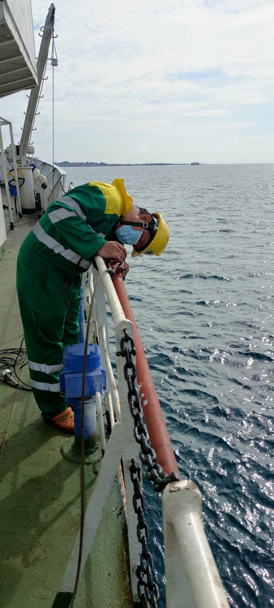
Figure 2. MGB-MGSD staff setting-up the echo sounder transducer before deployment
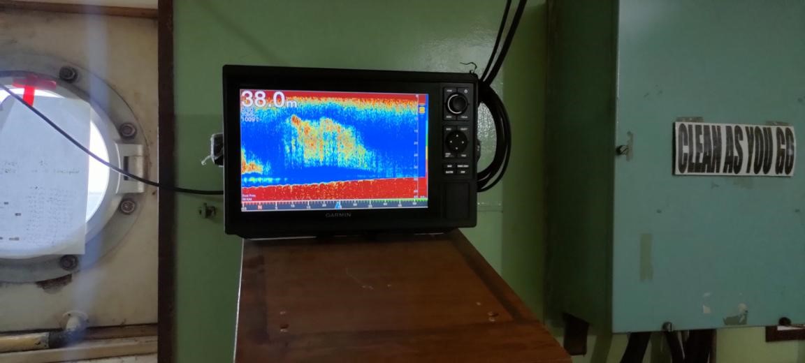
Figure 3. Sonar reading showing a gently sloping seabed (red at the bottom) with possible school of
fishes (yellow to orange above the seabed - red bottom) swimming.
For the geology aspect, it is not enough to know the outer features of the area, much interests lie in the characteristics of the materials underlying it. With sub-bottom profiling, it shows in two dimensions the subsurface information, underneath the seabed without the hassle of drilling or sampling hundreds of samples, since this is impractical. This method uses seismic refraction where transmitted waves refract at boundaries between different media due to differences in properties. These yields range of velocities that characterizes lithologies, sediment sizes and compaction, and rock types. To supplement this data, geological sampling was done. Using these samples, we could study their mineral and fossil content, which enables us to know the provenance (the source of these sediments), the depositional history in the area, and its economic potential. Different sampling equipment were utilized. Piston and gravity corers were used to obtain core samples, where layering is more or less preserved. For surface sediments, we employed Van Veen grab sampler, where we collect sediments similar to getting stuffed toys in claw machines found in malls or theme parks. Most of our samples were obtained by carrying out the latter sampler. The samples were dried to allow the sediments to be stored for a long period of time without undergoing any unwanted microbial reaction.
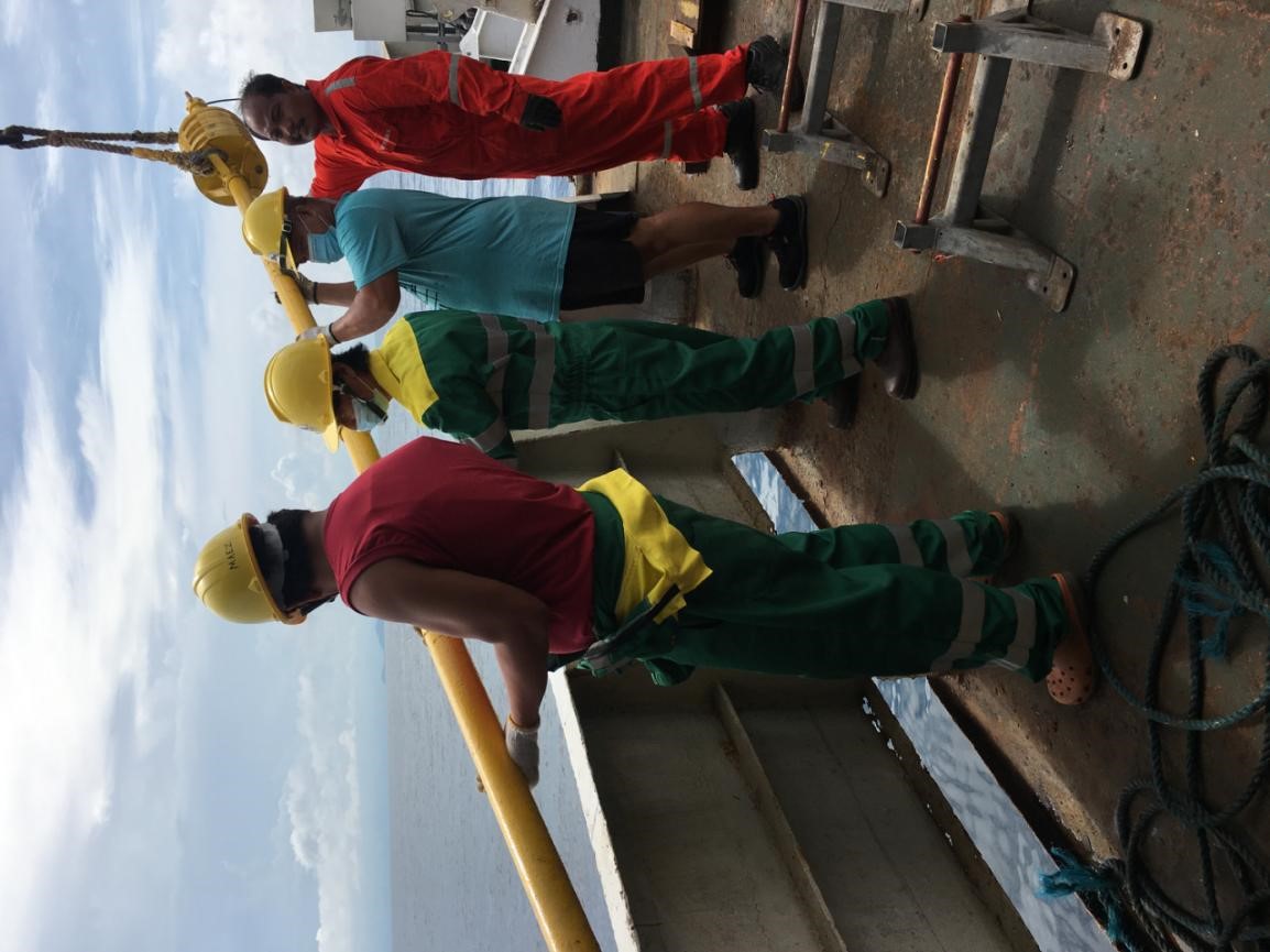
Figure 4. Deployment of piston corer by the MGB-MGSD staff with the assistance
of the RPS Explorer's crew
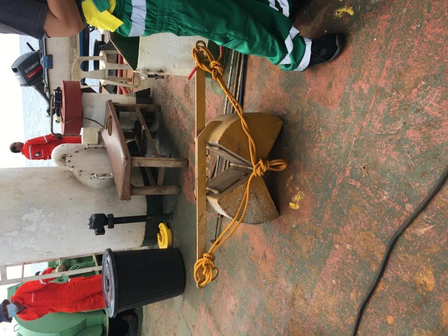
Figure 5. Van Veen Grab Sampler
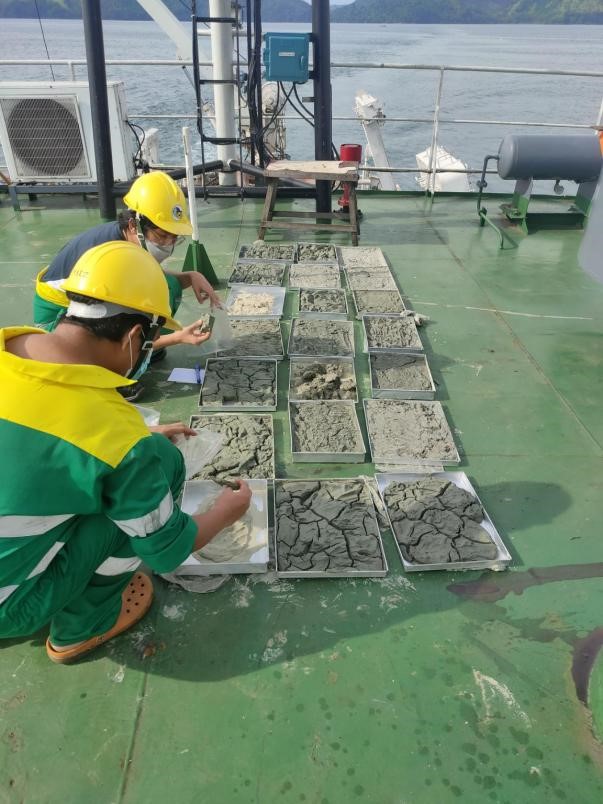
Figure 6. Air drying of samples laid out in an aluminum tray
Before conducting the offshore survey, courtesy calls to local government units were initiated in order to inform them about the activities that we are going to conduct in their provincial and municipal waters. With this, we docked at several ports across the target provinces, not only to do courtesy visits but also as an opportunity to replenish our essential goods and supplies. The first of the three stop was in the city of Zamboanga. The city is located at the southwestern tip of the Zamboanga Peninsula. The city is highly urbanized, with clusters of malls and establishments, it did feel that we didn’t leave Manila.
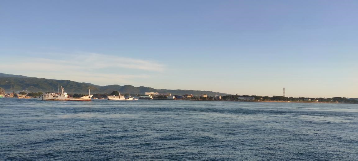
Figure 7. Ships anchored beside the beautiful coastline of Zamboanga City with mountainous
landscape peeking at the back
Next stop was in Pagadian City, the capital of Zamboanga del Sur. Fishing being one of their primary economic sectors, the first thing that will welcome you as you set foot on the city from the port is the fish scent coming from the numerous markets offering all sorts of fish products, wet or dry. The nightlife in the boulevard is a must-try experience when visiting the city.
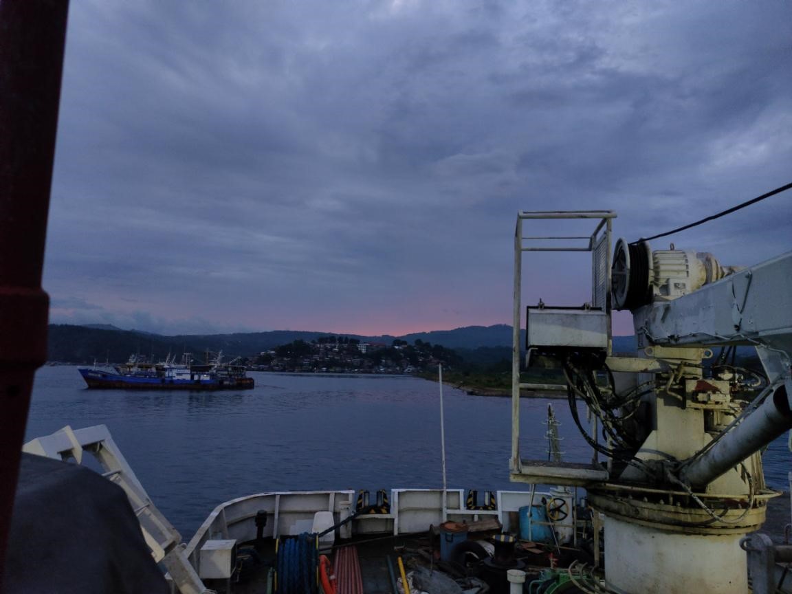
Figure 8. The dusk sky over the coastal area and the hilly terrain of Pagadian City
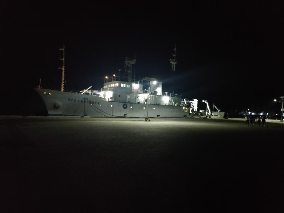
Figure 9. The RPS Explorer docked at the port of Pagadian City
Lastly, we docked at Kalamansig, one of the coastal municipalities in the province of Sultan Kudarat. Unlike in the previous cities where we docked, we had an opportunity to study the outcrops fringing the coastal areas of Kalamansig. It is to verify the existing geologic map and also to provide us information about the source rocks of the sediments brought to adjacent nearshore and offshore areas by drainage systems and other geological processes. Despite sustaining minor wounds from the slippery rocks, it was a thrilling and happy experience to remember. After this, we did our replenishment of food supply and materials while enjoying a sunny day at this beautiful Municipality.
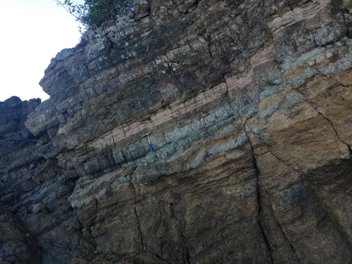
Figure 10. Layering of rocks (a sedimentary formation) fringing the coast of Kalamansig
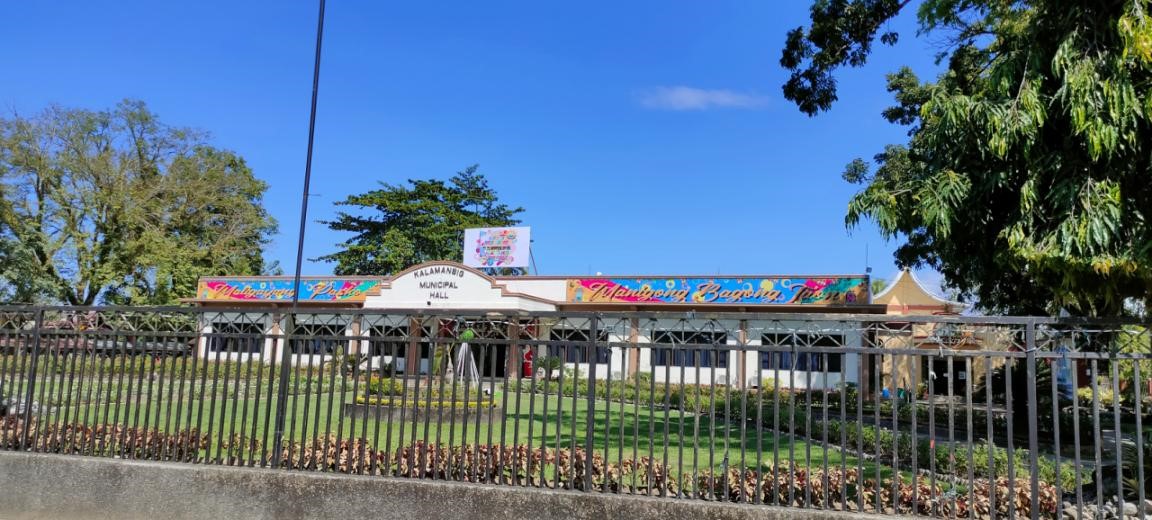
Figure 11. The Kalamansig Municipal Hall
]
Indeed, it was an experience to cherish and to learn from. The tiring sampling activities, sleepless monitoring of the seismic instrument, the happy and bored moments onboard, and city visits were all the things I will definitely look back and cherish. I’m looking forward to participating again in future offshore fieldwork to gain more experience and apply the knowledge that I acquired from this cruise.
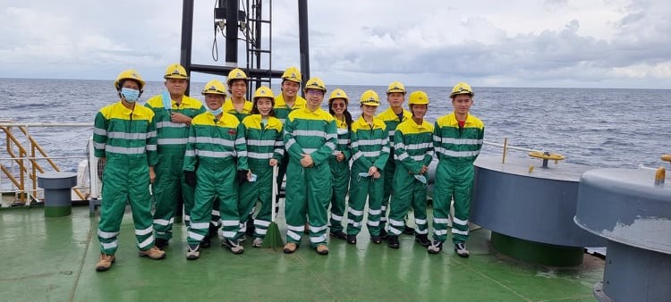
Figure 12. The MGB-MGSD Marine Mineral Exploration Section staff in
green and yellow coverall while cruising Sulu Sea.
By: Arvien Terence D. Cudilla, Marine Geological Survey Division