
A team headed by Mr. Crisostomo V. Masangkay, Senior Geologist from Marine Geological Survey Division (MGSD) of the Mines and Geosciences Bureau (MGB), conducted marine geophysical/geological survey on board the RPS Explorer from August 22 to September 19, 2022 as part of the MGB’s on-going five – year project on “Geological Studies and Mineral Resources Assessment of the Philippine Rise”. Mr. Masangkay heads a team of eleven (11) technical staff of the MGSD from the Marine Mineral Resources and Marine Technical Services Sections.
On one occasion during the RPS Explorer’s docking at the port of Real, Quezon, the entourage of Mayor Bing Diestro-Aquino made a courtesy visit to the vessel for a brief tour and was oriented on the basic function and capability of the platform.
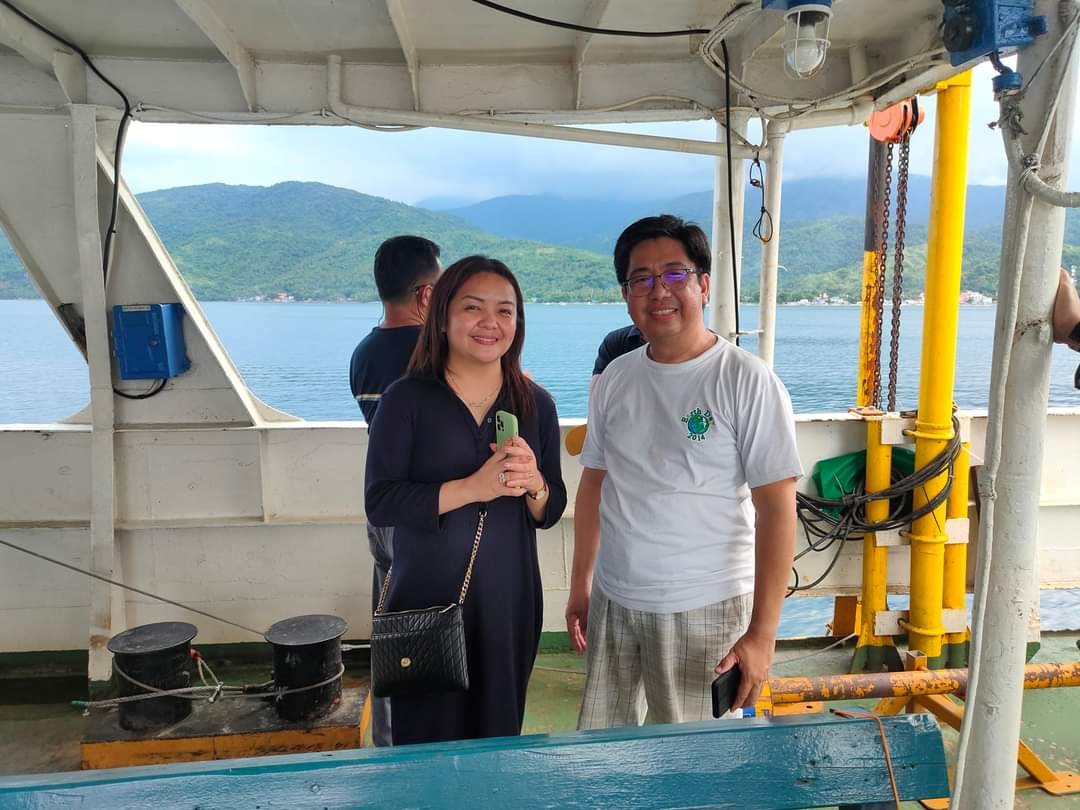
Mayor Bing Diestro-Aquino together with Mr. Rogel A. Santos, Ph.D. during their visit to the RPS Explorer.
Moreover, sub-bottom profiling and sea bottom topographic measurement (bathymetric survey) were conducted along the offshores of Quezon and Camarines Norte Provinces. These geophysical data are used to have a glimpse of the seafloor topography and its sub-bottom structures to be able to understand the geology of the seafloor. A total of 2,318 line-km of tracklines were traversed utilizing the RPS Explorer, the research vessel of the MGB.
Initial results of the bathymetric study revealed several hills/knobs dotting the relatively flat seafloor of areas east of Cagbalete Island, but offshore areas west of Cagbalete Island and within the Polillo Strait exhibit closely-spaced contour intervals indicating a steeply sloping seafloor. This negatively sloping seafloor is being interpreted as submarine canyons.
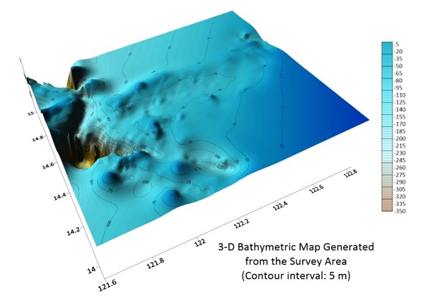
Generated map from the sea bottom topographic measurements.
To complement the data gathered from this geophysical survey, grab and piston core sampling were conducted offshore. A total of 42 sediment samples were collected along the coasts of municipalities of Atimonan, Plaridel, Gumaca, Mauban, Perez, Infanta, Real, Polillo, General Nakar, Panukulan, Alabat and Quezon in Quezon Province. Most of the samples are mud to fine sand with mafic minerals and minimal traces of biolithics. Sampling is simultaneously conducted with the water quality measurements (physio-chemical determinations of seawater). Water quality data can be used in determining if there are exceedances in the parameters set by the Department of Environment and Natural Resources (DENR), thru DENR Administrative Order Nos. 2016-08 and 2021-19, whether contamination or natural signature of water quality may pose risks to the ecosystem, as well as, human health.
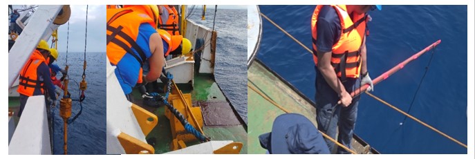
Some photos of the deployment of (from left to right) piston core, grab sampler,
and the simultaneousconduct of water quality measurement.
At present, seismic images are still being processed and interpreted which are expected to yield data on the geological processes and economic prospectivity of the surveyed areas. Sediment samples are still being prepared for detailed core logging and further chemical analysis of various elements like Au, Ag, Cu, Fe, Pb, Mn, Cd, Co, Cr, Ni, Hg, Zn and As.
By: Marine Geological Survey Division