
(a feature article by Engr. Dave Elwen Labadan)
Approximately 120 NM off the coast of the eastern seaboard of the Philippines lies the Philippine Rise (formerly known as the Benham Rise). Considered a gateway to the Pacific – the name coined by Spanish tripulantes to describe the calmness and serenity of the seemingly boundless body of water that it is – the waves and gale there are described as forbearing and tolerant.
Such description is a far cry from the beleaguering and tumultuous characterization by modern seadogs. The tripulantes were indeed right as the waters there were as pacific as can be, experienced by no less than our Marine Scientific Research (MSR) team, composed of the Marine Mineral Exploration Section (MMES) and the Marine Technical Services Section (MTSS), in May 2023 – welcoming as if to say, “Hey, bring it on!”
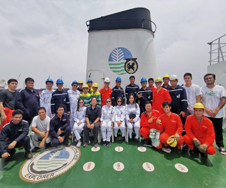
Figure 1 The MSR team together with the crew of the RPS Explorer (photo by Engr. Nathanael V. Ching, MTSS Chief)
In its nearly two scores of existences, the DENR’s flagship and only research vessel, RPS Explorer, had only explored as far as the territorial waters of the country in the eastern seaboard. It has not reached the confines of our exclusive economic zone (EEZ) there, much less explore it. The waters in the said region are so dreaded that even the Navy and the Coast Guard send only their large ships there. For reference, the Navy sent BRP Velasquez, an 85-meter, 2,516-tonner ship, to the Philippine Rise in 2018 as the platform for the first ever geological and geophysical survey of the region, involving the MSR team of the MGB. Said ship is almost twice as long, and four times as heavy as the RPS Explorer, which is but a meager 50 meters long and 697 tons heavy. This means that “stat-wise”, the Navy’s ship is far more capable of battling the formidable raging waters of the region. However, with the careful, meticulous, and highly scientific approach in the planning of the trip by MSR team, the seemingly impossible goal of surveying and exploring the Philippine Rise using our very own RPS Explorer was achieved not only safely and soundly, but with flying colors.
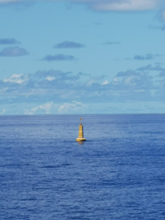
Figure 2 Buoy marker set-up by the Philippine Navy in 2018, marking the Philippine Rise as part of the Philippine Territory (photo by Engr. Nathanael V. Ching, MTSS Chief)
The collaboration of the MMES and MTSS teams resulted in a remarkable execution of the plans from the scheduling of the vessel routes to the 24th geophysical data gathering paving the way to a comprehensive survey and assessment of the Philippine Rise. The modern approach in the maintenance of the RPS Explorer proved to be one of the keys to the success of the trip. The MSR team’s revolutionary and innovative manner of executing maintenance works on the ship made all the difference, striking a perfect balance between maximizing the allocated budget and delivering maintenance works of paramount quality. Also, the “lead-by-example” style of leadership by the MSR team over the ship’s crew played a vital role in the successful accomplishment of the trip’s goal. This was made possible through a strict implementation of safety protocols to improve the “safety culture” aboard the ship, together with the implementation of the newly developed risk management system, wherein risks that could possibly come along and cross paths with the trip were well prepared for. Furthermore, the timely and cautious execution of the plans as the trip went along was the culmination of it all, paving the way to a 150% accomplishment of the target line kilometers, and a 100% of the target number of samples.
The MSR team rose to the occasion of exploring the Philippine Rise using the RPS Explorer and raking in an impressive target accomplishment. Such is a poignant feat worthy not of clandestine celebration. Surveying, not to mention, exploring the vastness of the seas, surfing through the cradling humungous waves, far away from home, is no comic – a job not for the chicken-livered.
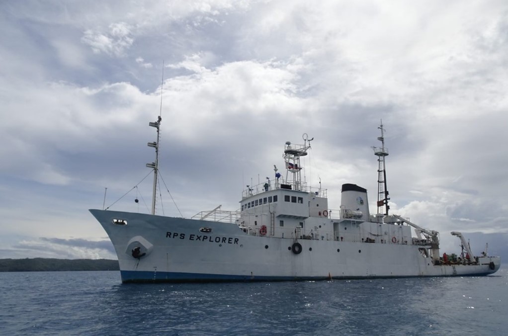
Figure 3 RPS Explorer view while on anchorage taken from the service boat leaving ashore off the coast of Dilasag, Aurora (photo by Engr. Dave Elwen M. Labadan, MTSS)
Truly, and indeed, “impossible” is the limitation of a goal. It is merely a word, a part of vocabulary of those faint of heart. In the case of RPS Explorer and the MTSS, it not only embodied such an ideal, but it defied all apprehensions and surpassed all expectations as it ages very gracefully. “Life begins at forty”, as they say, seems to apply not only to humans but also to things. When one really takes good care of things, it lasts. As such, the MSR team shall continue to passionately take care of the RPS Explorer, live with its motto: “Excellence is not our standard; it’s our way of life” and continue to deliver results beyond the impossible.
By: Marine Geological Survey Division