
Seas surrounding mainland Palawan are dotted with small islands and islets which are enclosed by a stretch of white beaches with occasional patches of rocky shores. These areas present high potentials for ecotourism and interesting dive sites. Sprawling the northern Sulu Sea are the island municipalities of Cuyo, Cagayancillo, Magsaysay, and Agutaya, collectively known as the Cuyo Group of Islands (CGI). While to the west, sprouting in the southern portion of the West Philippine Sea, are the islets of the Kalayaan Municipality. A team from the Marine Geological Survey Division (MGSD) recently assessed these areas regarding their susceptibility to coastal geohazards.
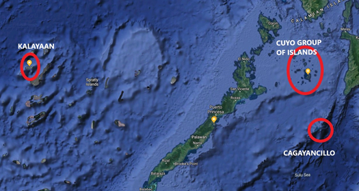
Photo 1: Encircled in red are the island municipalities of Kalayaan, Cagayancillo, Cuyo, Agutaya, and Magsaysay. Photo from Google Earth.
Kalayaan, the smallest municipality in the Philippines, is generally composed of emerging cays, banks, and coral islands/islets. The largest island of the municipality is Pag-asa, the 2nd largest island in the Spratley’s Group measuring approximately 32.7 hectares or 81 acres in size. The entire municipality is surrounded by coral reefs and shoals, serving as buffer protection against strong waves and currents. Since most of these islands/islets are just emergent reefs, the highest landmass barely stands 50 meters above sea level.
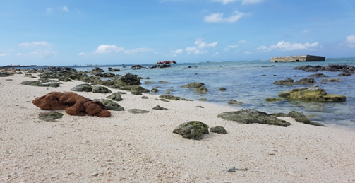
Photo 2: Scattered coral blocks, fringing corals and barrier reefs serving as wave breakers in Brgy. Pag-asa, Kalayaan,
Observations made by the MGSD team indicate that most of the Kalayaan islets are relatively flat and covered by white to cream sand and pebbles, which are made up of coral and shell fragments. In Pagasa Island, the beach is somehow pinkish, showing specks of reddish sand which, on a closer look, turned out to be broken fragments of the red organ pipe type coral, Tubipora musica Linnaeus. These are admixed with broken seashells, algae, and even foraminiferal tests.
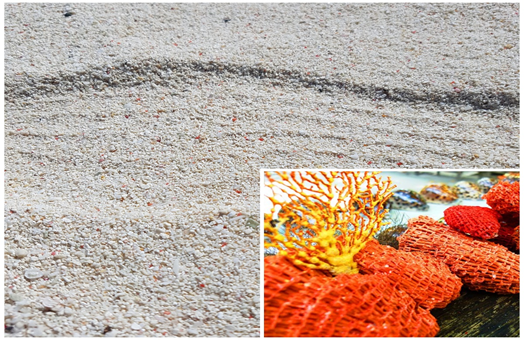
Photo 3: Sand in Pag-asa Island which is typically made up of white to buff coarse- to fine-grained sand admixed with fragments of Tubipora musica, Pag-asa Island, Palawan. Inset Photo: Tubipora musica (Photo from https://wikivisually.com)
The islands of Cuyo Group, on the other hand, are relatively bigger and of higher elevation. They mostly composed of inactive volcanoes and massive volcanic flow deposits. Other islands have beaches lined with boulders, cobbles, and pebbles of basaltic rocks. The billowy and vesicular surface of the rocks suggests bubbly lava with escaping gas during ancient eruptions. Quinimatin Island, which was not reached by the MGSD team, is reportedly a scenic limestone island.
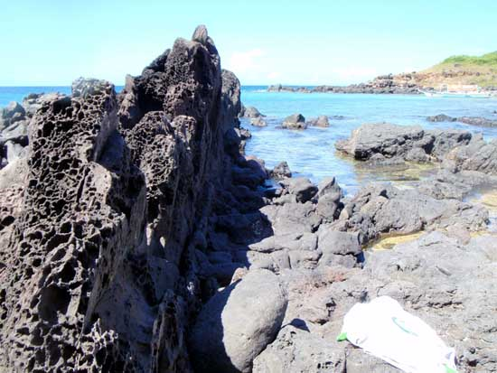
Photo 4: Prominent vesicles on the surface of basalt rocks exposed in Pandan Island, Cuyo municipality.
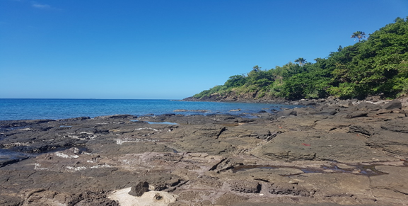
Photo 5: Fractured basaltic flows spread along the beach of Brgy. Balading, Bisucay Island, Cuyo town. Natural littoral pools observed.
CGI manifests flat to slightly rugged landscape that reaches peaks ranging from 90 to almost 300 meters above sea level. Boctong Island has the highest peak.
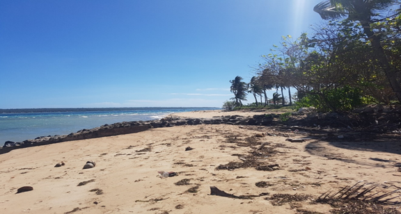
Photo 6: Unprotected sandy beach in Brgy. Lipot, Cagayancillo
Based from a study of the University of Colorado Sea Level Group, records revealed that for the period 1992-2011, the rate of global sea level rise averages to 3.1 (+/- 0.4) millimeters per year. This occurrence is attributed to climate change, which could exacerbate the strength of waves and sea level rise in the near future. On the other hand, the rate around the Philippines for the same period was fast accelerating recorded to be 5.8(+/- 0.6) millimeters per year. If such rate of sea level rise will continue, it is apparent that some of our coastal communities will face increasing flood risk and the low lying islets can vanish like some tiny Pacific Islands, which was reported to have disappeared due to rising seas and erosion.
Though results of recent MGSD’s survey suggest that these islands under study are moderately to highly susceptible to coastal erosion, coastal communities in Cuyo and Kalayaan Groups will likely experience coastal inundation, and a few, especially in Kalayaan, can disappear in decades. Strong waves and wind associated with climate change will force people along the coasts to move to higher places or transfer to other islands.
By: Marine Geological Survey Division