
A team from the Marine Geological Survey Division (MGSD) of the Mines and Geosciences Bureau conducted marine geophysical/geological survey in the Philippine Rise Region (PRR) off Baler, Aurora and parts of Polillo islands last April 15 to May 12, 2019 as part of the MGSD five – year project on “Geological Studies and Mineral Resources Assessment of the Philippine Rise.”
To know what lies on the seafloor and within the ancient layers of sediment beneath it, sub-bottom seismic profiling, bathymetric survey and aquascan side-scan sonar imaging were performed in the offshore of Aurora, adjacent to the Northeast Luzon Trough. Results of this process are expected to show a glimpse of the topography of the seafloor, its underwater structures and an understanding of the geology of this region. A total of 890 line-km of tracklines were covered on board a “basnig” fishing boat, serving as their survey platform.
To complement the data gathered from this geophysical campaign, rock and sediment samples were likewise collected offshore and along the coasts to check potential economic minerals in it. Offshore samples, mostly mud and fine sand, were collected using dredge sampler. Rock samples were, however, taken from Zabali and Sabang beaches in Baler.
Initial results of the bathymetric study revealed several hills/knobs dotting the relatively flat seafloor of the target areas. However, seismic images are still being processed and interpreted, which are expected to yield data on the geological development and prospectivity of the surveyed areas. Rocks and sediment samples are still being analyzed for their mineral contents.
By: Marine Geological Survey Division
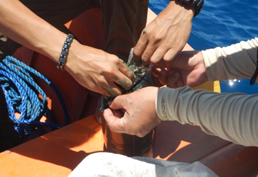
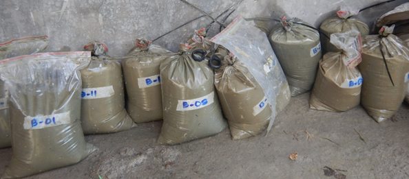
Sediment sample was placed in a labeled and sealed sample bag.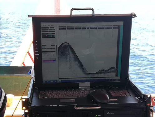 Seismic profile showing one of the seamounts that the team encountered.