
The Lands Geological Survey Division (LGSD) of the Mines and Geosciences Bureau (MGB) Central Office conducted the "Workshop on the Standardization of Procedures for Geologic Quadrangle Mapping" on March 7 - 11, 2016 at The Contemporary Hotel, Quezon City, attended by geologists of MGB Central and Regional Offices.
The Workshop was about standardizing the methods and outputs for Geologic Quadrangle Mapping, and encompassed a series of comprehensive lecture about basic mapping techniques, standardization of methodology for mapping, Philippine Stratigraphy, unified map format and other related topics. It also involved one whole day of geological mapping field work at a quarry site in Tanay, Rizal.
In her welcome remarks, Ms. Lilian Rollan, Chief of LGSD, underscored the importance of Geologic Quadrangle Mapping, being a core function of LGSD at MGB, and the many uses of geologic maps to society.
Atty. Danilo Uykieng, MGB Assistant Director, in his message, also emphasized that the Geologic Quadrangle Mapping activity should be treated as an opportunity to gather all the necessary interrelated data which are relevant to the various facets of MGB, such as mining, geohazard, geologic and environmental.
Invited resource speakers who are former MGB geologists include Mr. Rolando Peña, Consulting Geologist of Geoscience Foundation, Inc., Mr. Arnulfo Cabantog, Consulting Geologist of Apex Mines Co, Inc. and Dr. Mario Aurelio, Director of the University of the Philippines-National Institute of Geological Sciences.
The Workshop was the initial activity for the implementation of the Geologic Quadrangle Mapping Project of MGB starting 2016. After the Workshop, the MGB geologists from the Central and Regional Offices will be deployed to Region III, the Project's target area for 2016, to finish the 1:50,000 scale geologic mapping of 64 quadrangles in the region. The geologic map output will be GIS-based, and is expected to be extremely useful for many practical applications such as in mineral exploration, groundwater resource and vulnerability assessment, solid waste disposal site selection, land use planning, and other applications.
Since 2005, MGB has not published any new 1:50:000 scale geologic quadrangle map. Thus, 2016 marks MGB's bid to go back to basics: its core function of producing geologic maps.
By: Lands Geological Survey Division
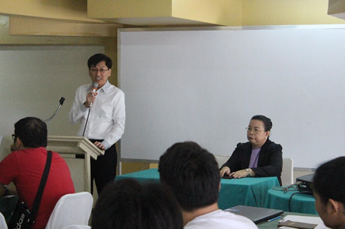 Assistant Director Atty. Danilo Uykieng delivering his message to the participants
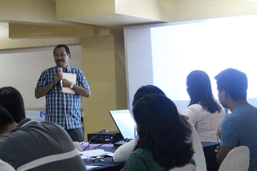
Mr. Arnulfo Cabantog , Consulting Geologist of Apex Mines Co, Inc., discussing the basics of geologic quadrangle mapping and parts of a technical report.
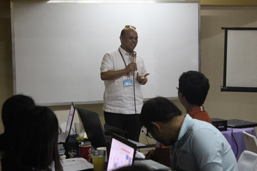
Director of the National Institute of Geological Sciences (UP Diliman), Dr. Mario Aurelio answered queries on structural geology and basic mapping techniques.
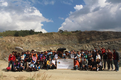
Participants from MGB CO and Regional offices conducted fieldwork at a quarry site with well-exposed rock outcrops and notable structural features (background) in Tanay, Rizal. Rock formations observed and identified are the Masungi Limestone, Kinabuan Formation and Maybangain Formation.