
Feature Story
EarthCaching as defined by the Geological Society of America is an exciting educational activity through which you can learn about the Earth and the natural processes that shape our planet over time.
By combining GPS technology with outdoor field experiences we can experience the wonders of the Earth in an entirely new and entertaining way. In the case of an on-going Coastal Geohazard Assessment Program Project under the Geohazard Mapping and Assessment Program of the MGB,the program’s methodology appears predisposed on geocaching, which if warranted, may simply be expanded to advance the eco-tourism endeavors of the country.The Philippines, being an archipelagic country, with its 7,641 islands, are teeming with stunning coastal features that are constantly subject to modifications that can take place insplit seconds or thru millions of years of nature sculpting depending on the forces of wind and waves; the amount of sediment transport and in rare circumstances, the scale of tectonic upheavals that an ocean front may receive.Evolution of the coast is either undergoing erosion or accretion, and in both ways has the potential to generate hazards or may create amazing landforms in the process.
The westernmost peninsular section of Pangasinan encompassing the municipalities of Bani, Agno, Dasol, Burgos and Infanta, have been experiencing active coastal progressions and in the process creates magnificent coastal features, noteworthy attributes for earthcaching.While some occur in recurring patterns and highly reliant to the prevailing wind and longshore drift, others have pronounced coastal shifts that can be attributed to geologic/geomorphologic signatures and anthropogenic imprints.
The said coastal segment is traversed by two major drainage conduits - Dasol and Agno Rivers, and their tributaries. Headwaters of these riverine systems emanate from the western gradients of Zambales Range anddrain at their river mouths finally converging with the West Philippine Sea.The coasts are usually lined with sandy shorelines dotted with limestone formations. Rocks outcroppingalong the beach are sometimes bedded and massive sedimentary rocks belonging to the Sta. Cruz and Zambales Formations. Proximal active tectonic structures causal to this coastal geomorphology are the Manila Trench found west offshore, the East Zambales Fault and the northern segment of the Philippine Fault zone.
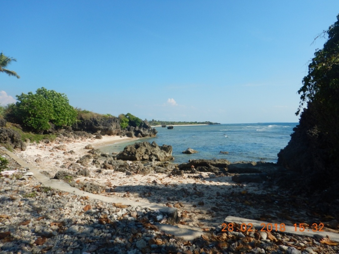
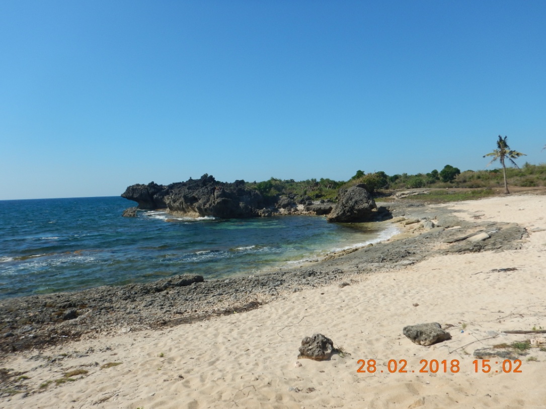
Generally, the seaboard fronts are exemplified by long and extensive beaches intertoungued by pocket beaches and small coves with craggy headlands. Most of the beaches are blanketed by coral derived sandy sediments. Blowouts, beach cusps and berms outlined sand dunes covered some beaches. Fringing and uplifted coral reefs served as coastal frontier and defense vis-à-vis onslaught of waves. Sea caves, sea arcs, sea stacks and sea stumps are common seascape in active coastal sections, mostly found in promontories together with wave-cut notches and wave-cut platforms. These coastal features are the product of coastal erosion and coastal depositionand in the process created awesome coastal featuresideal for earthcaching, a few are briefly discussed below.
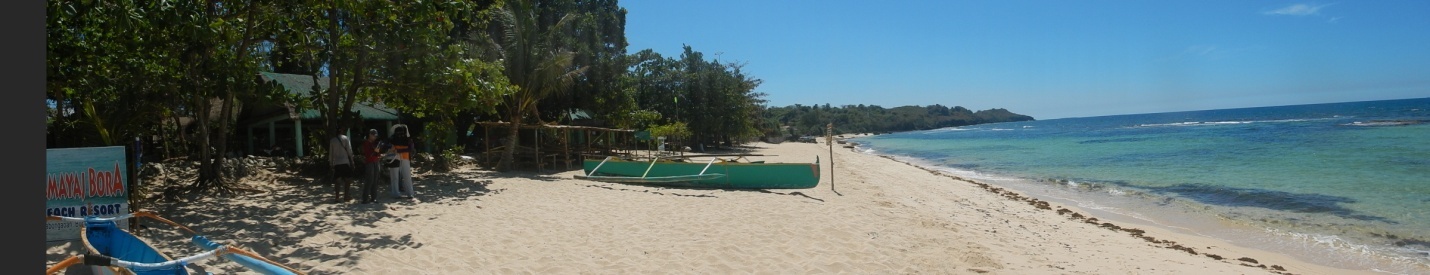
Boracay of the North
The coastline of Brgy. Ilio-Ilio in Burgos municipality forms part of a curvilinear inlet locally known as Caboangan Cove. It is locally famous as the Boracay of the north. It has slightly elevated (about 5°-8°) shoreface enveloped by thick deposits of coral-derived sand and shingles.Sand dunes deposits reach farther backshore. Fringing reefs nearshore help dissipates the onslaught of advancing waves.
This beach is embraced by cliffy promontories of Naiyantayan Point found north and Tambobo Point found south. Rock falls, wave cut-notches, sea stacks and sea stumps are the main coastal features in both promontories. Promontory is high energy zone since waves are refracted around them.
Boracay of the North enclosed by rocky promontories:
 Naintayan Point
 Tambobo Point
Tambobong Beach -Depth (Deep) Pool
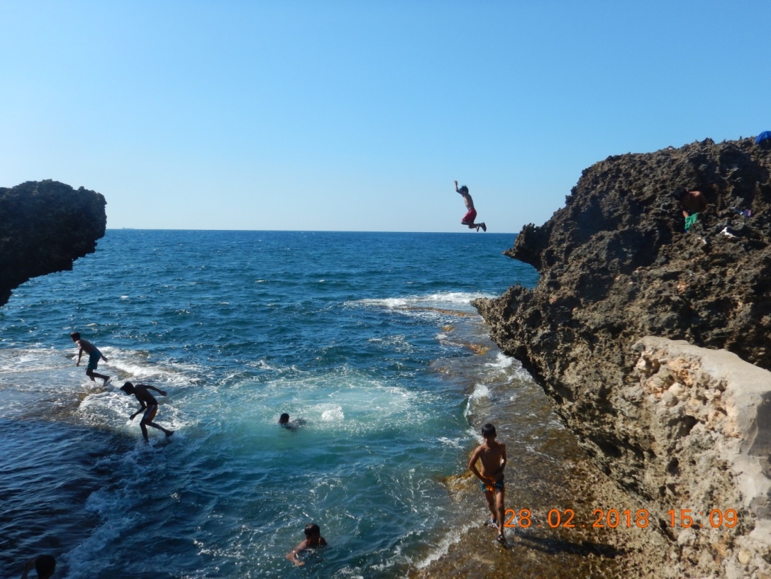
The coastal fringe of Brgy. Tambobong in Dasol municipality is located along the south trending western headland that forms part of Caiman Cove, directly facing the West Philippine Sea. Its coastal proximities are characterized by discontinuous rocky shoreline of raised coral reefs with successions of pocket beaches in-between. The raised coral reefs have maximum heights of ± 20 meters above mean sea level (amsl). Jagged cliff face, wave cut-platforms, wave-cut notches and minute blowholes are typical features of the overlying rock facie. Other coastal erosional features such as sea stacks and sea stumps are also present. A circular seawater filled abyss (locally known as Depth/Deep Pool), probably a collapsed sinkhole, is now attracting local tourists.
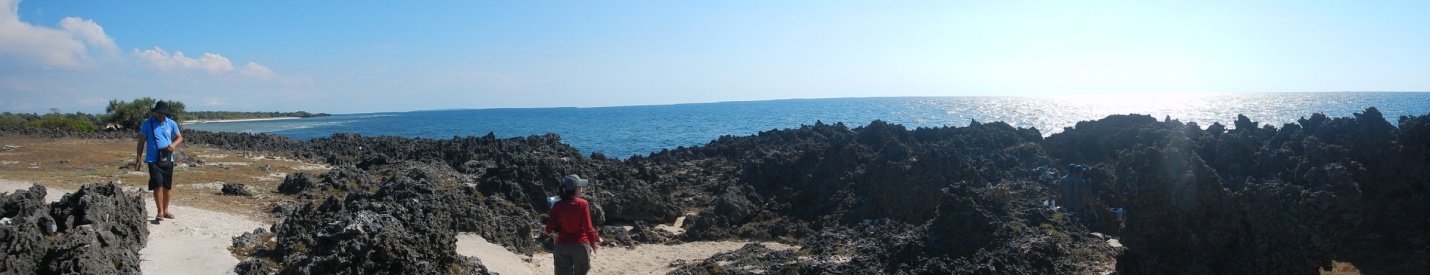
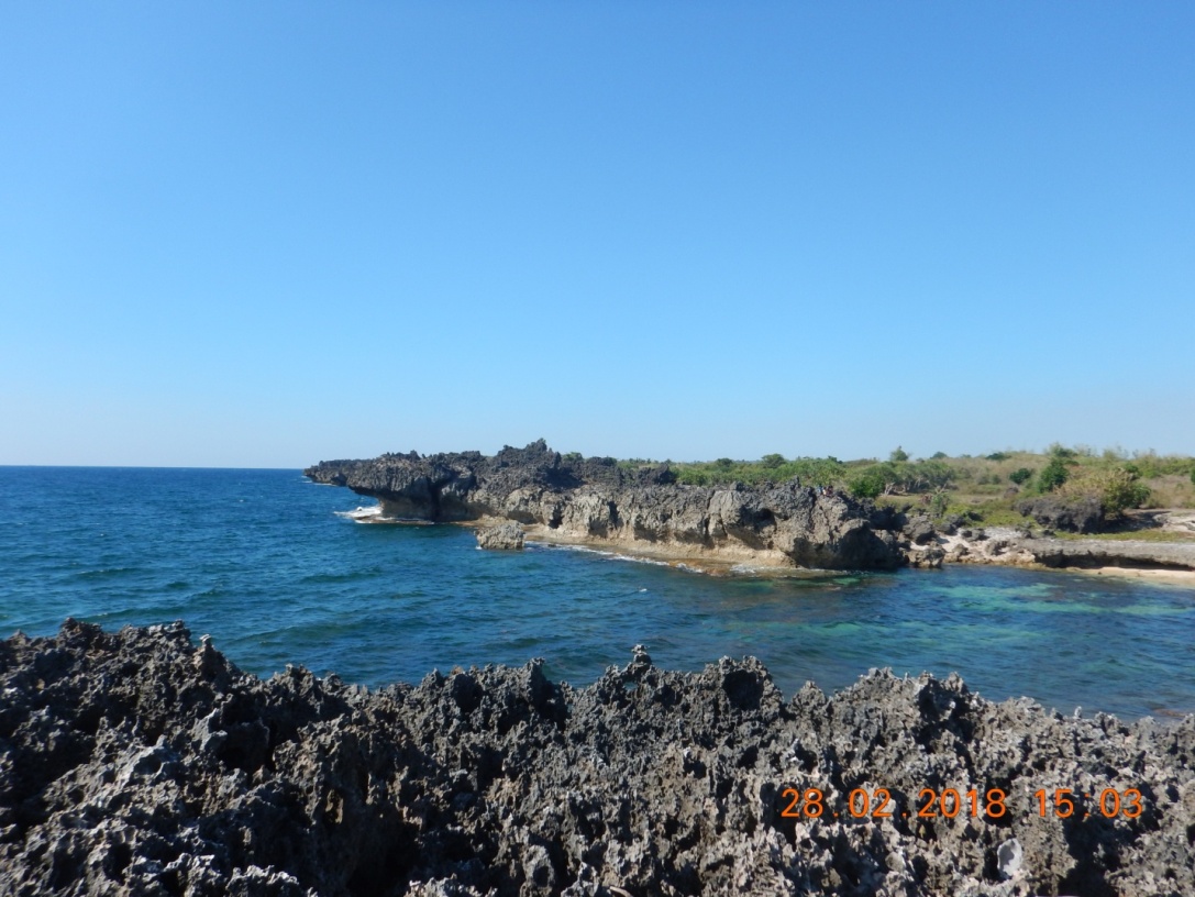 Panoramic view of raised karstic coral reefs (photos above and below)showing pinnacled top and notches at the base located at So. Pedig/Banalo and partly within geographic coordinates N16°9’44.7” and E119°46’21.4”.
 This circular abyss could be a collapsed sinkholeor pothole found in So. Pedig/Banalo.
Walkways within this karst topography (Deep/Depth Pool area) and around some sharp cliffs have been cemented for easy and safe access of the tourists.
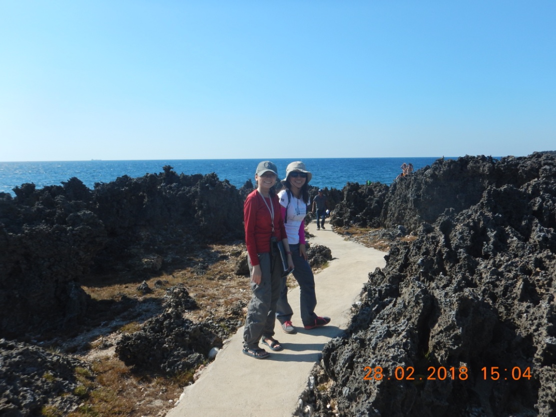 Cemented path approaching the Deep (Depth) Pool
Pocket beachesare generally attaining narrow and elevated (±7°) shoreface covered with thin to thick, coarse to fine coral- derived sand and boulders. Smaller discontinues wave–cut platforms likewise floored the foreshore of some pocket beaches.
 Rocky pocket beach near the Deep Pool (So. Pedig)
 Beachfront with wave-cut platform (So. Pedig).
Noah’s Arc
A small islet known as Noah’s Ark is found near the border of Brgys. Malacapas and Uli, in Dasol. The beachfront belongs to a river-dominated estuarine coastal setting formed by confluence of DasolRiverand nearby small ones such as Masonson, SalabosonandTanabong rivers.
Dasol River receives high amount of sediments from its tributaries found tracing the extensive outcrop of Zambales Formation. Rock formations commonly consist of interbedded tuffaceous sandstone and shale, conglomerate and limestone.
Noah’s Ark is underlain by well bedded calcarenite and mudstone, a detached chunk of land that looks like a ship similar to Noah’s vessel. It was separated from the nearby mainland thru undercutting/landslide and possibly due to structural weakness/block collapse. Wave cut-platforms and wave cut- notches are apparent at the detached bluffy islet.
The coastal evolution of the Noah’s Arc could be a good material for earth sciences and geotourism.
 Semi-oval detached block of land locally known as Noah’s Arc photographed at far distance.
 The detached block showing horizontally bedded calcarenite and mudstone; prominent notch exhibits a hanging cliff.
Dasol River drains at the coastlines of Brgy. Uli in the west and Brgy.Amalbalan,bringing sand that is deposited as sandspits and sandbars. A tombolo (sandbar or sandspit that connects an island to the mainland) is formed between the detached island and mainland.

 Extent of sediment deposition as photographed south (upper photo) and north (lower photo)
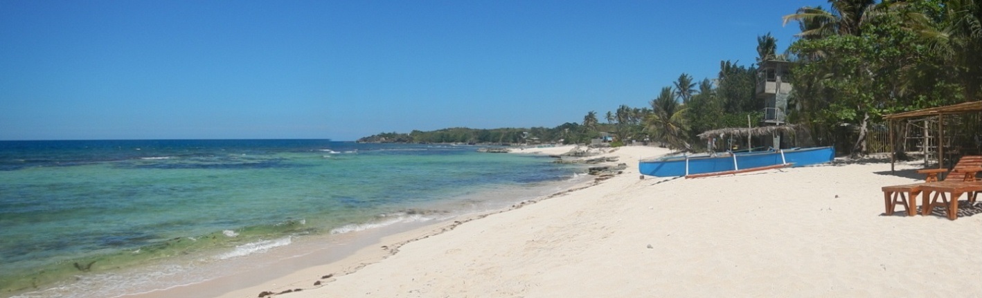
Abagatanen Beach
The seaboard front of Brgy. Baruan in Agno municipality forms part of a U-shaped cove known to locals as Abagatanen Beach. It is sandwiched by promontories of Nabitayan Point and Barani Point. The coastal front of the barangay suggests an estuarine coastal setting formed by the combined actions of Locloc and Baruan Rivers molded by the dynamic actions of wind, longshore drift and waves emanating from the West Philippines Sea.

 Crystal clear, blue waters of Abagatanen Beach backdropped by buff sandy cover is sandwiched by headlands (upper and lower photos).
 Fringing coral reefs found nearshore helps dissipate the forceful waves from attacking the shore.
The coastline is overlain by medium to fine grain coral-derived sands and shingles. Fringing coral reefs tend to dissipate wave energy prior reaching shoreline.
Sand spits occur as narrow ridges of sandy to pebbly deposits projecting at the mouth of Baruan River that occasionally cause inland flooding due to partial closure of the mouth of river, particularly during the monsoon and stormy season.

Umbrella Rock
A lobe-like coastal setting awaits in Brgy. Magsaysay, Agno municipality. It is drained by short tributaries emanating from the peak of Mount Nagtoon. The beach face is overlain by coral-derived sands with very rough edges implying nearby provenance.
An adjoining sea stacks locally known as the “Kissing Rock” is also a welcoming view that can entice tourists and also adds onto other features such as sea arc, wave-cut platforms and sea stumps.
 Two adjoining sea stacks known as the “Kissing Rock” found in PurokGinhawa
 Sea Stackfound along the shoreline of PurokGinhawa
 Sea arc along the shoreline of PurokGinhawa
Aloleng Beach
Brgy. Aloleng forms part of a wide U-shaped coastline facing Agno Bay. It is situated in an estuarine environment formed by the actionsof merging rivers flowing from its main water conduit, the Mabini River, enhanced by the dynamic actions of wind, longshore drift and waves emanating from the West Philippines Sea.
Common coastal features along the beachfronts of the barangay are beach cusps, berms and dunes, known components of wave-dominated estuaries.
Beach is covered by thick deposits of well-sorted fine grain sands. Magnetite sands occur in low concentrations.

 Wind and wave dominate beach front of Aloleng Beach in So. Namnama
Olanen Beach
The coastal fringe of Brgy. Dacap Sur is situated along a V-shaped cove fronting Olanen Bay. It is bordered by steeply sloping hills with maximum altitude of about 150 meters above mean sea level. Few west-southwest flowing streams/creeks drain loads of sand toward the coastal front of Olanen. Headwaters of these small surface water conduits are found immediately west of the area and are found traversing the massive interbedded tuffaceous bodies of sandstone and shale, conglomerate and limestone of the Zambales Formation and the bedded to massive coralline limestone of the Sta. Cruz Rock Formation. The outer flanks of the cove are hosted by corraline limestone, a more resistant rock.
The constricted beach face is enveloped by fine sands and shingles while some portions are covered by rock boulders.

Google Image-no available photos (Piding file)
Baruan Bay
The coastline of Brgy. Gayusan in Agno forms a U-shaped cove facing Baruan Bay. Limestone promontory refracts and energy is concentrated around them. Said coastal features are typical to regressive coastal zone.
 U-shaped Baruan Bay fronting BrgyBaruan, Agno

Summing up, coastal deviations that are happening along the westernmost peninsular section of Pangasinan have resulted to remarkable coastal geomorphological features creating beautiful landscapes that could be at par or possibly beyond par compared to other provinces like Palawan Province with its pride, El Nido and Coron; Bohol Province of its Panglao Island and Aklan Province on its famous Boracay Island.
By: Marine Geological Survey Division