
The coastal geohazard assessment conducted in the Province of Leyte by teams from the Marine Geological Survey Division of the Mines and Geosciences Bureau (MGB) revealed that municipalities in the northwestern coasts are likely to be affected by landslides and rockfall, while the eastern seaboard of Palo, Tolosa, Tanauan, Dulag, Mayorga, MacArthur and Abuyog are moderately to highly prone to coastal erosion.
The result of this activity helps coastal communities prepare for the effects of changing storm regimes driven by strong effects of climate oscillations like El Niño and La Niña.
Information derived from this study is especially important in light of potential future climate changes associated with sea level rise to reduce, if not totally inhibit, the destructive effects and impacts of the natural hazards on the coastal population.
Future impacts associated with storms, tectonic movement and sea level rise amplify the region's vulnerability to coastal hazards, highlighting the need to mobilize people in the coastal barangays, to mitigate the effects of natural hazards on lives, properties and the environment.
The study showed that the erosion rate was further aggravated by the effects of strong typhoons like "Yolanda" and "Ruping". The coastlines on the east and the towns on the Pacific side are particularly dynamic as they are often exposed to strong waves and storm surges generated hundreds of kilometers away in the Pacific Ocean.
These are evidently manifested by the presence of long sandy beaches, sheared coastal cliffs, dramatic headlands, and ultimately the power of the Pacific Ocean that serves to erode and change the shape of the coast especially during monsoon season and catastrophic typhoons.
On the western side of Leyte, assessed to be moderately to highly susceptible to marine erosion are the coastal areas of Baybay City from Brgy. Hipusngo up north to Brgy. Maybog, near the boundary with the Municipality of Albuera. These include Brgys. Poblacion 22, Poblacion 21, Poblacion 20, Poblacion 16, Poblacion 9, Poblacion 8, Candadam, San Isidro, Sta. Cruz and Kilim.
Most of these coastal areas are characterized by long sandy beaches covered by unconsolidated alluvial deposits largely composed of sand, granules and pebbles that are easily carried away by waves and currents even at calm sea conditions. The presence of uprooted coconut trees as well as of partly to completely collapsed hard engineering coastal protection structures are indicative of severe coastal erosion in the past.
Some coastal barangays in the towns of Villaba, Leyte, Tabango, San Isidro and Calubian were found susceptible to coastal landslides and erosion attributed to steep unstable slopes underlain by weathered loosely consolidated rocks. This shoreline behavior is further enhanced by its proximity to the Philippine fault. The fault traverses the Biliran Strait and roughly follows the coasts of Calubian and Leyte towns making it more susceptible to mass movement, earthquake and erosion.
Limestone and karstic areas are rather stable and relatively resistant to erosion. However, fractured portions are prone to rock slide and rock fall.
At Brgy. Jubay, Pal-og and Caruyucan in the town of Calubian, annual erosion rates were recorded ranging from 0.5m/yr to more than 1m/yr. Strong wave attacks during Amihan season promotes coastal erosion along these coastal barangays.
Heavy siltation was observed along the coast near river mouths and intertidal flats as well as in undisturbed mangrove forests.
Among the accretion-prone barangays are: Brgy. Tigbawan in Leyte municipality with highest accretion rate of 7m/yr. Moderately prone to accretion are Brgys. Tabing and Butason1 in Tabango; Bawod and Basud in San Isidro; Railes and Villahermosa in Calubian, and Tahud in Inopacan.
By: Marine Geological Survey Division
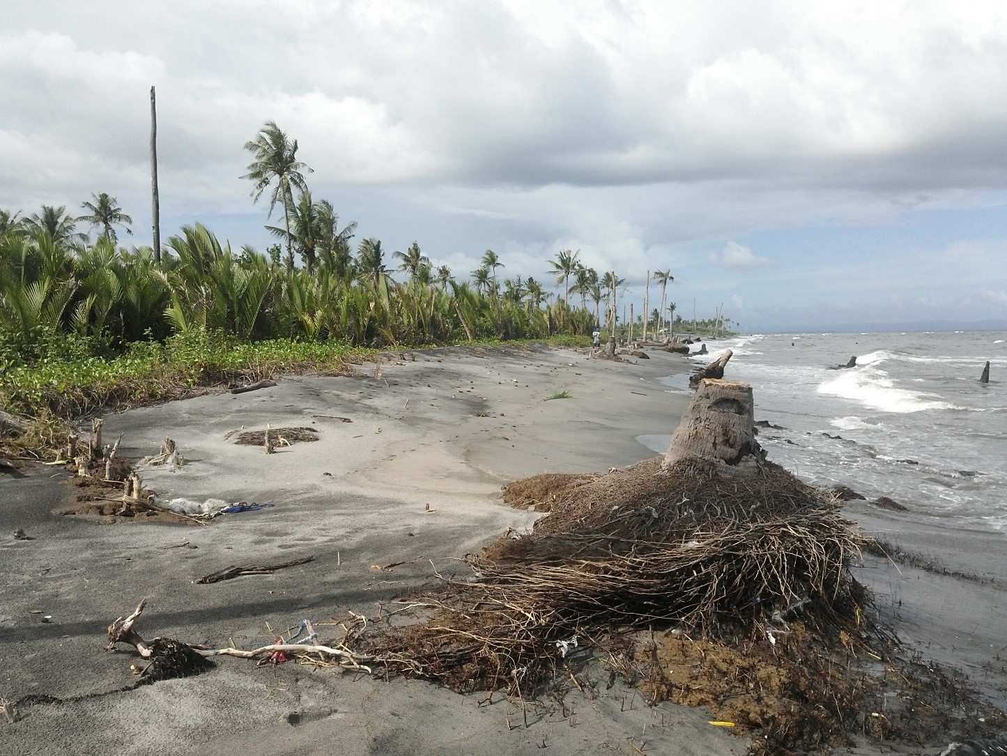
Uprooted coconut trees and diminishing shore were observed in Brgy. Hipusngo, Baybayin City, Leyte. These are evidences of high susceptibility to coastal erosion.
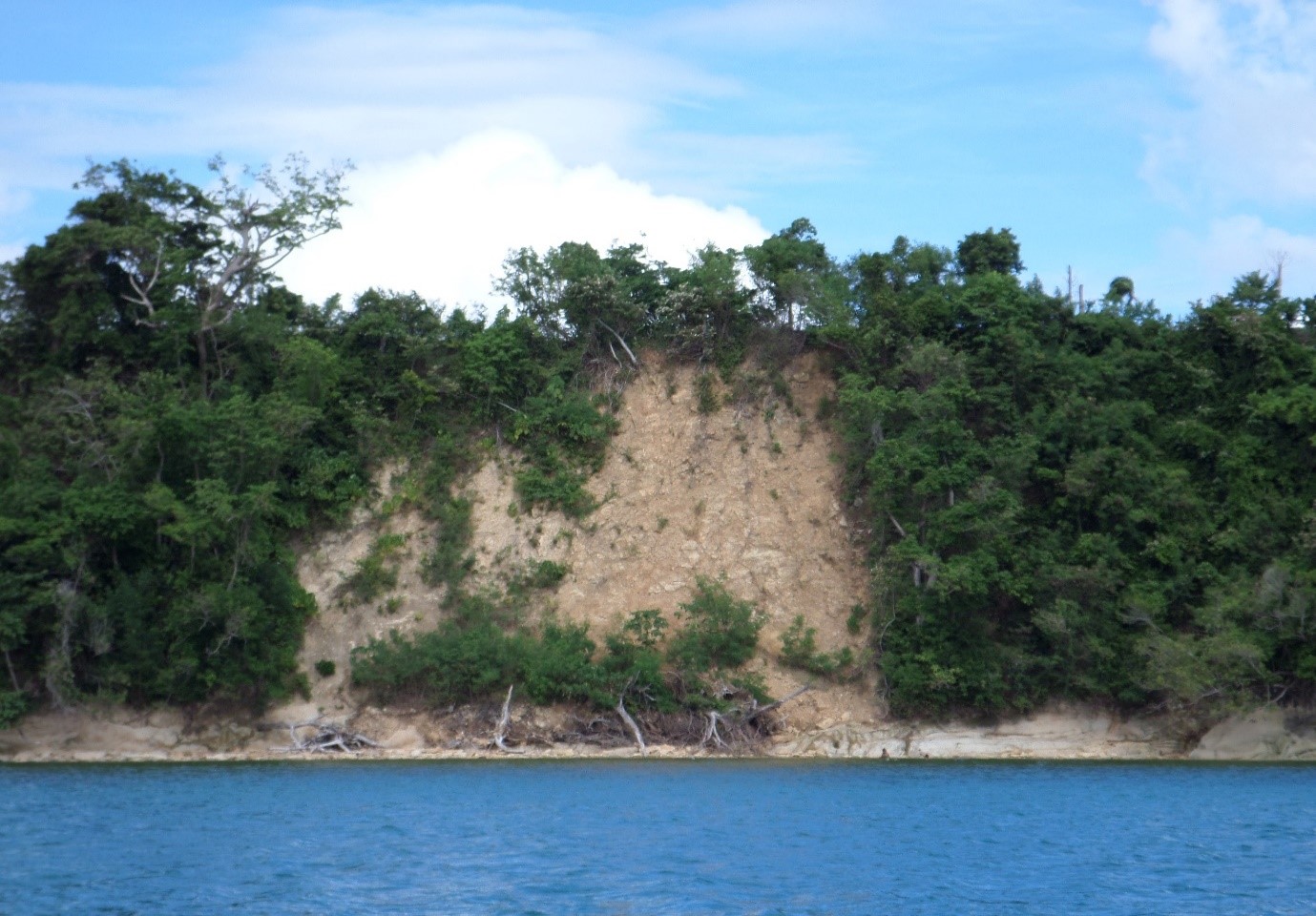
Landslide along the limestone hills of Brgy. Libagong, Villaba, Leyte. The colluvium of trees and soil indicates the recent mass movement in the area.
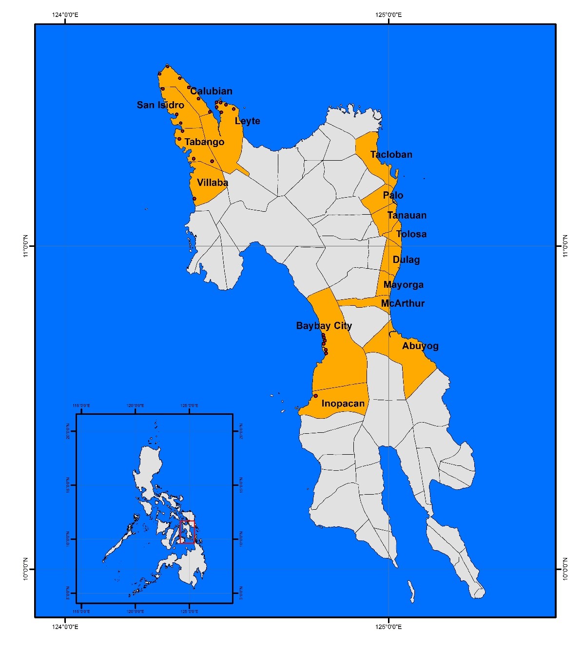
Some of the coastal barangays of Villaba, Leyte, Tabango, San Isidro and Calubian are prone to mass movement while most of the towns of Baybay City, Palo, Tolosa, Tanauan, Dulag, Mayorga, McArthur, and Abuyog are highly susceptible to coastal erosion. Heavy siltation is observed in some barangays in Calubian, Leyte, and Inopacan.