
The Marine Geological Survey Division (MGSD) of the Mines and Geosciences Bureau (MGB) hosted a seminar-workshop on “Methodologies, Concepts, Tools, and Best Practices on Coastal Geohazards Assessment” among geologists and IT personnel from MGB Central and Regional Offices last August 3-6 at the Subic Travellers Hotel in Olongapo City.
It was aimed at reviewing the progress of the Coastal Geohazards Assessment Project and the role of methodologies in planning policies and strategies. It was designed to enable the participants to best cope with climate change impacts on coastal hazards and to enhance field and mapping methodologies, as well as reporting schemes.
Dr. Fernando P. Siringan, Director and Professor of the University of the Philippines-Marine Science Institute, gave lectures and field demonstration on the causes and responses of our coastal zones to the processes of erosion, accretion and other geologic developments. Being an expert in this field, he shared practical techniques on proper field assessment and interpretation of coastal sediments and rock outcrops, changes on rock and beach configuration and deformation, and field structures and effects of anthropogenic factors.
The proper approach to geohazard assessment, case studies and practical examples were also presented and reviewed, such as the marine inundation events and islands formation in Lian, Batangas, and the co-seismic coastal changes triggered by the October 2013 Bohol earthquake, among others.
Ms. Maria Angelique Doctor, another resource speaker, discussed coastal responses to extreme events like the impact of Typhoon Yolanda in Leyte and other long-term forcing mechanisms on coastal and marine environments. She also shared techniques on the application of the Digital Shoreline Analysis System in map preparation.
Field lectures and demonstration on beach profiling and other techniques were also conducted along the coastal segment of Subic Bay near Barangay Kalaklan, Olongapo City.
A presentation was also made on the set-up and operation of the Differential Global Positioning System Real Time Kinematics as a high-precision positioning tool for coastal and marine survey.
In the end, the participants agreed that data integration of the results of actual field surveys, satellite images and anecdotal interviews bear importance in the interpretation and estimation of hazard probabilities. They also discussed other issues and concerns regarding the implementation of the coastal geohazard assessment project.
The standardized preparation of coastal geohazard maps will be tackled in another seminar-workshop to be held in the immediate future.
By: Marine Geological Survey Division
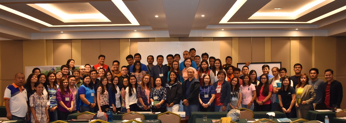 The participants together with the resource speakers, Dr. Fernando Siringan and Ms. Ma. Angelique Doctor (center, front row)
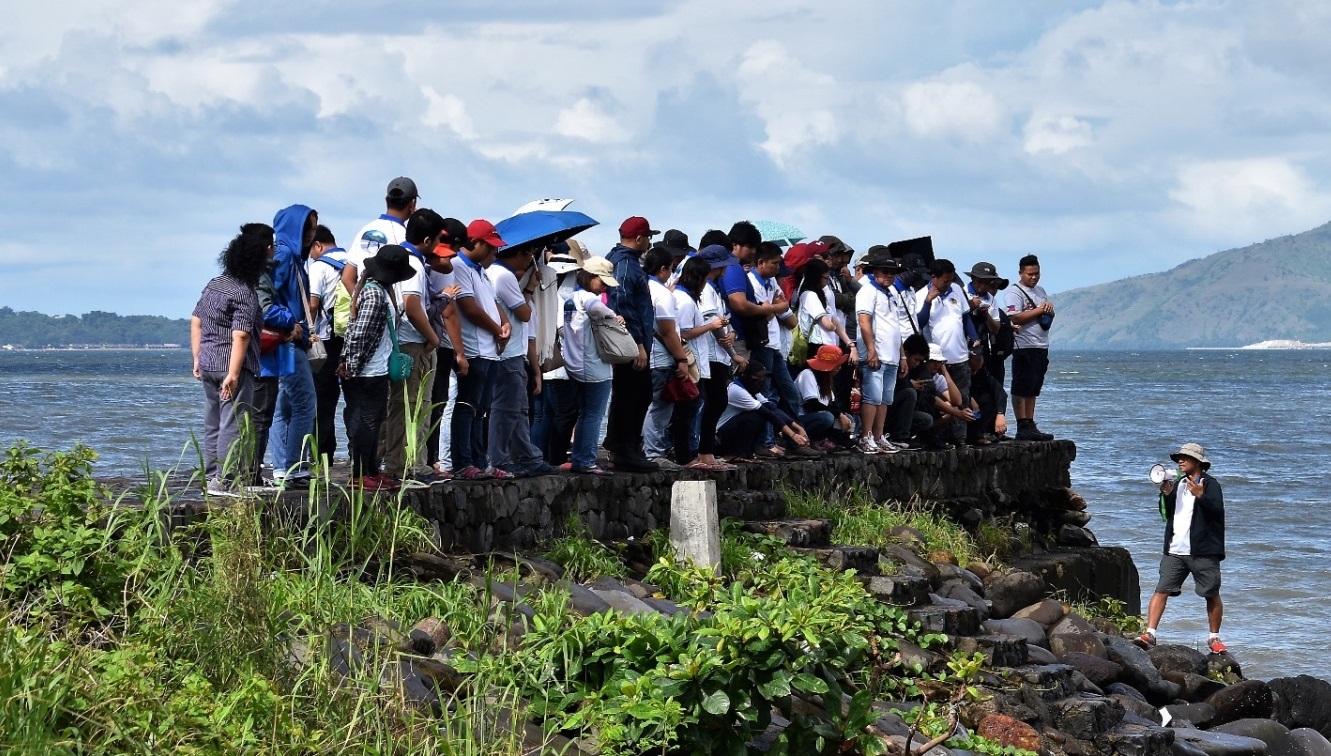 The participants atop a boulder-filled jetty during the field lectures and demonstration of field techniques by Dr. Siringan along a coastal segment of Subic Bay at Barangay Kalaklan, Olongapo City
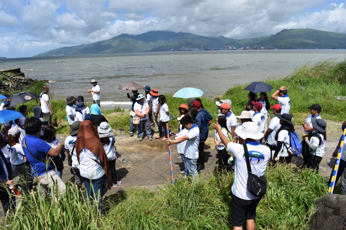 Demonstration on the conduct of beach profiling and other field techniques
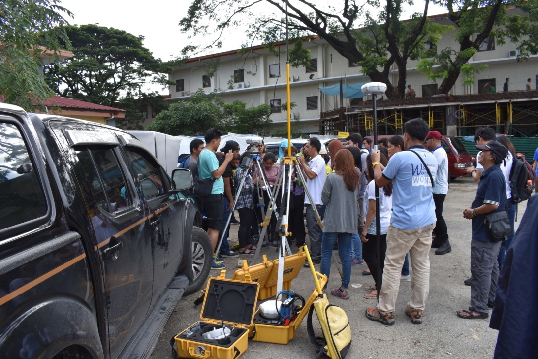 Demonstration on how to install and use Real Time Kinematic (RTK) satellite navigation